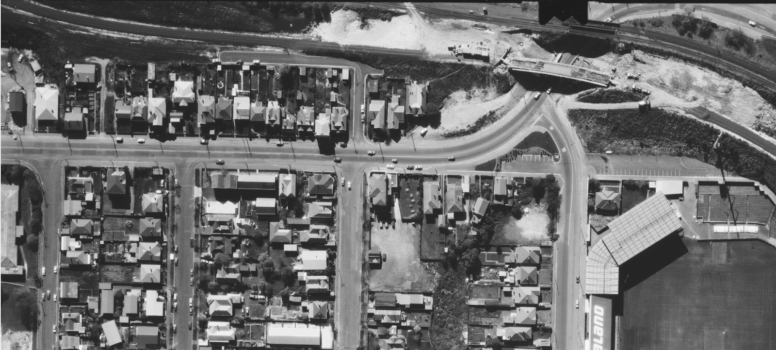
Yesterday I started to extract layers from the maps for Dunedin and have 1942, 1972, 1985 and 2013 to play with. Today I found a couple of errors which I have fixed, and also added 1985/1986 layers to Kensington. This includes a 1986 survey of Hillside Workshops which shows the beginning of singling of the MSL from Dunedin yard to Caversham and also the deviation around Caversham being put together. It is interesting that the deviation work began in 1979 but took something like 8 years to complete. The first time I travelled by train through the area was in 1987 and did so again in 1989. On both of those trips, up the Otago Central to Clyde, I was completely unaware of what was happening around Dunedin with the singling and realignment of the railways in the area.
A 1986 aerial survey of Hillside Workshops yields this view of the post-singled main as it crosses from the right hand side of the Andersons Bay Road bridge to the left hand side of the King Edward Street bridge. At lower right is the Caledonian Grounds, now the site of the Warehouse carpark.
The overbridge at King Edward Road was rebuilt as a single track structure with new abutments and piers, for unknown reasons, as it is practically on the same alignment as the left side of the original double track structure from the 1910s. The siding for Hillside Workshops comes down the side of the embankment to the left of the bridge.
Work underway to deviate the railway line with the new single track bridge at South Road under construction with the original railway bridges above it and the new embankment built. Foundation work is also underway for the first motorway bridge for the original 2 lanes. This only slightly encroached upon the double track rail bridges. The 2nd motorway bridge for 4 lanes now sits more or less completely within the 1910 railway bridge corridor.


