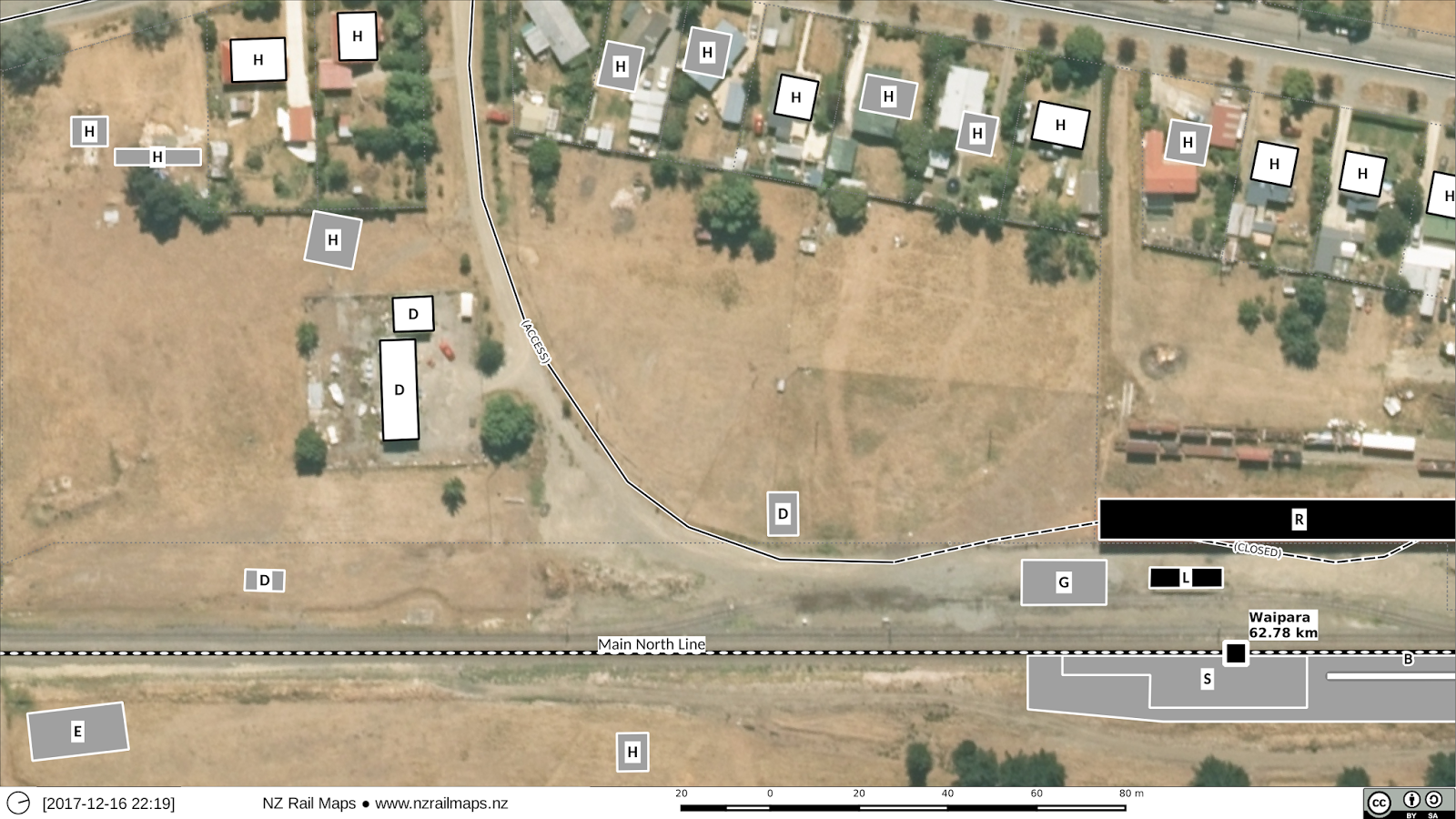
Once again this article is not in either a MNL or Waiau Branch series, because these pictures are another set of samples rather than a complete set of maps for Waipara. I am warming to the idea of doing a Waiau Branch series, and also adding the 1950 aerial of Waipara to the 1961, 1972 and 1979 ones I already have, for a specific set of maps for that date. There was an aerial series produced in 1934 which I can’t find any trace of, and there are probably also later ones but I haven’t yet attempted to find any details of such, so at the moment there is a big gap from 1979 until 2015 or 2016 when the current aerials were produced.
Les Dew’s book pages 144-161 have helped fill in much of the detail of what each building was. Every building or structure is traced from an aerial photo in its actual position and the styles indicate the status of each:
- Black – an existing railway building/structure (either KRL or WPR)
- Grey – a former railway building/structure (that doesn’t exist any more).
- White with solid border – an existing building that may or may not have ever been a railway building in the past.
- Transparent with dashed border – a former building (gone) that was never a railway building.
Mostly what was at this end are the NZR engine shed (E), way and works depot and other various sheds including the country works depot which still exists (D), the various houses (H) including at upper left “The Kennels” which was the singleman’s accommodation and the stationmaster’s house near the way and works depot, and as we head to lower right, the Weka Pass Railway rolling stock shelter (R), the original goods shed (G), loading bank (L) and the original platform and station building (S).
Note there are not many of the original 16 or so houses still there today. Some have been long gone; others have disappeared more recently in private ownership.
Now let’s look at the north end:
There is a bit of an overlap so I will just go into the middle. In upper centre labelled (A) is what used to be the Waipara staff social hall and is now the staffroom for the Weka Pass Railway. Directly below that is the former stockyards (Y), the Weka Pass Railway engine shed (E) and the old footbridge (B). Then there is also the present day KRL platform and the station building (S). To the right of the stockyards you can see where a privately owned building used to be, where some of the Weka Pass Railway’s yard tracks go through. It’s evident that a strip of land at the back of that property must have been sold to the WPR to enable them to put the extra tracks in for their rolling stock shed and the storage tracks next to it, as this land was never part of the railway yard.


