The maps have now been produced all the way to Otira. A few issues have been found along the way, these will be fixed with an updated edition by the end of this year, which will include the rest of the main line all the way to Greymouth, and hopefully the Midland Line branches as well. Currently being worked on for completion over the next few days are the maps of the separate MRH section which covers the Midland Railway Co’s proposed incline over Arthurs Pass which would have been graded at 1 in 15 similar to the Rimutaka Incline but much longer at around 10 miles. It was suggested that it could be worked by the Abt rack system. When the Government took over the MRC works they briefly investigated the incline possibility but it was soon determined that a tunnel under the pass was much preferred and this eventually resulted in the contract for the tunnel being let to John McLean & Sons who commenced work in 1908 and were supposed to have the tunnel finished in five years (1913). The defaulting of McLeans on the contract resulted in the work being taken over by the government and it required a further five years to achieve hole-through (1918); lining the tunnel then took three years (to 1921) and then a further two years was needed to install the electrification which included the coal fired power station at Otira. Hence the opening date was set down for 4 August 1923, and the centenary of this will be celebrated in two weeks’ time.
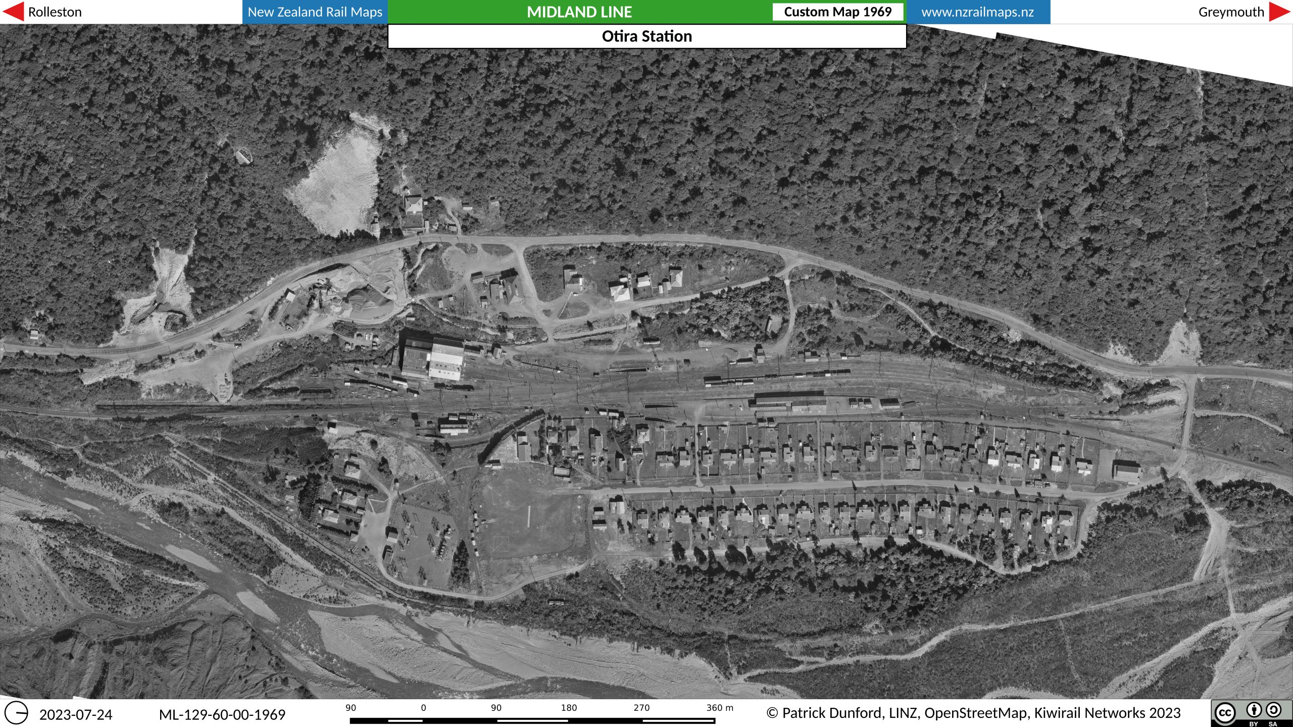
The maps will be available from the Volume 7 page on this site as the usual zip file, however there are also some special custom maps produced such as the one below which is for Otira in 1969, which is from the official New Zealand Railways aerial survey of the station. These custom maps have been produced at 1000 dpi (instead of the usual 100 dpi) so that they can be blown up to a very large size without losing quality, so that the full detail of the original aerial photos can be seen. The custom maps can also be obtained from the Volume 7 page. A GPX file for Volume 7 will also be available from this page. (N.B. the map shown below is not the full size one that is available for download from the Volume 7 page as WordPress has scaled it down in size. The full size one is 12598 x 7086 pixels)