
When the Midland Railway Company undertook to build the Midland Line between Springfield and Brunner, they had to come up with a way of getting across the Main Divide between Canterbury and Westland; the Southern Alps (Kaa Tiritiri O Te Moana) formed a formidable natural barrier between the two provinces. There was found to be a saddle through the range at this point, named “Arthur’s Pass” after the name of the surveyor who discovered it, Sir Arthur Dudley Dobson, at an altitude of 920 metres above sea level. As the railway stations at either side – Arthurs Pass and Otira – were at heights of 737 and 378 metres respectively, it could be readily ascertained that very steep gradients would be needed to get a railway over the Pass. The Midland Railway Co favoured the idea of a centre rail incline, worked by either the Fell or Abt systems, similar to the Rimutaka Incline in the Wairarapa region of the North Island. The steepest grades on this proposed line were, like those of the Rimutaka Incline, at 1 in 15, or about 7%. NZRM has produced a set of ten maps covering 10 miles (16 km) of the proposed route. Within that section, which goes from the present day Arthurs Pass station (known as Bealey by MRC) to Otira (Goat Creek), there were in addition the following stations proposed: Punch Bowl, Summit, Kopeki, Flat Top and Otira Gorge. Summit was located at the top of the grade and was by definition used as the zero peg for the mileages of the sections on each side. Thus, on the drawings and therefore the maps, the distances are shown on each side from Summit (Summit-Bealey and Summit-Otira). Several tunnels and numerous bridges were required; these are shown as per the diagrams, but only the locations of stations rather than specific details of facilities have been drawn. The 1 in 15 gradients were mostly found over the first 1 1/2 miles (2.4 km) below the summit on the Bealey side and down to about 5 1/4 miles on the Otira side, with levels carved out for the station yards, so all in all there would have been nearly seven miles (12 km) of this gradient, or more than double the length of the Rimutaka Incline, albeit both ascending and declining unlike the Rimutaka line which was a continuous uphill or downhill.
Turning now to the ten maps we can view each of these along with individual descriptions. We start at the Bealey end and work our way continually westward. Each map covers about one mile of corridor.
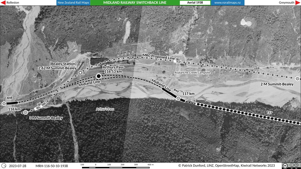
Starting near Rough Creek, the Midland Line would have crossed the Bealey River to reach Bealey Station. This route is very different from the present day, and basically reflects earlier plans to bring the railway up the true left bank of the Bealey all the way from its confluence with the Waimakariri River at Klondyke, including a bridge across the Mingha River. When the railway actually came to be built in the early 1910s, the PWD engineers sited this crossing 5 km downstream at “Bealey Bridge”. The location of Bealey Station is the same as where the first Arthurs Pass station was opened in 1914, at first named Bealey Flat until 1913.
Here the first station after Bealey, “Punch Bowl” is encountered. Grades have been easy to this point, but very rapidly will steepen to 1 in 15 and remain much the same all the way to the summit. Several bridges and a tunnel are encountered, including one bridge where the highway crosses overhead.
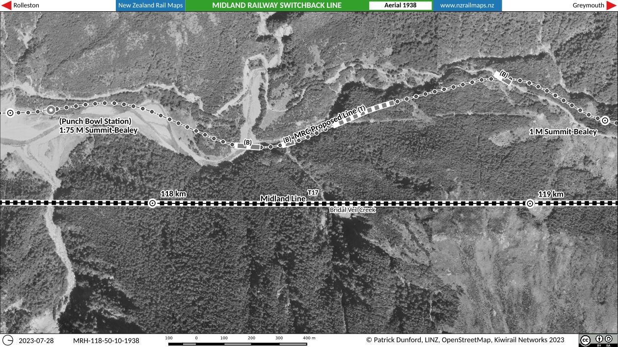
Underlining the significantly greater height at Arthurs Pass and consequently relatively short climb to the top, after less than two miles of a steep 1 in 15 ascent the switchback would have reached the summit. A few small bridges would have crossed various waterways.
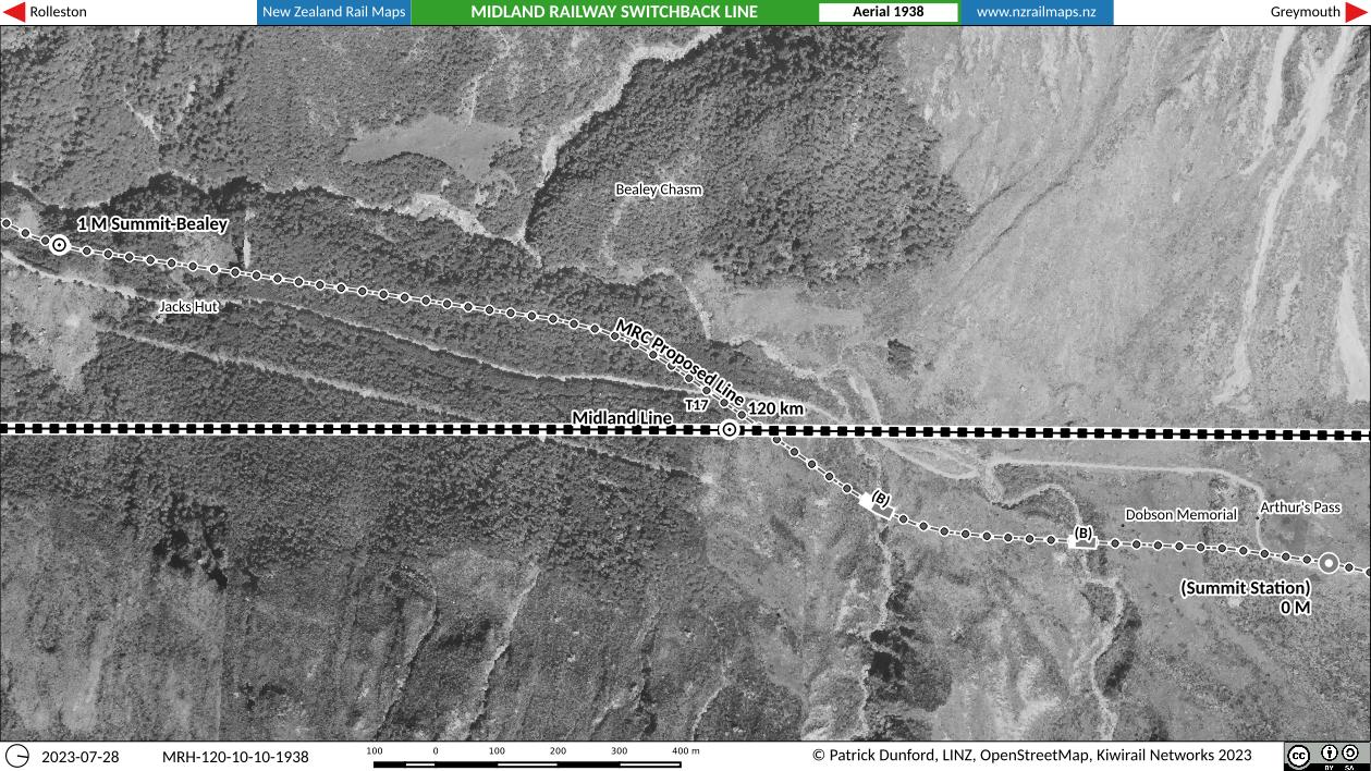
There would have been, of course, a vertical curve at the summit and after passing the Summit Station, the line would have descended steeply at 1 in 15, maintaining this gradient for the subsequent 5 miles with only relief for intermediate stations. There would have been a notable bridge crossing over the highway and Pegleg (or Kopeki) Creek.
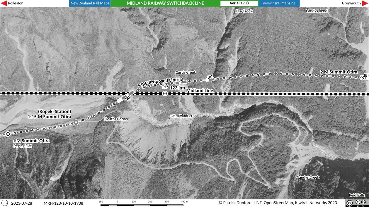
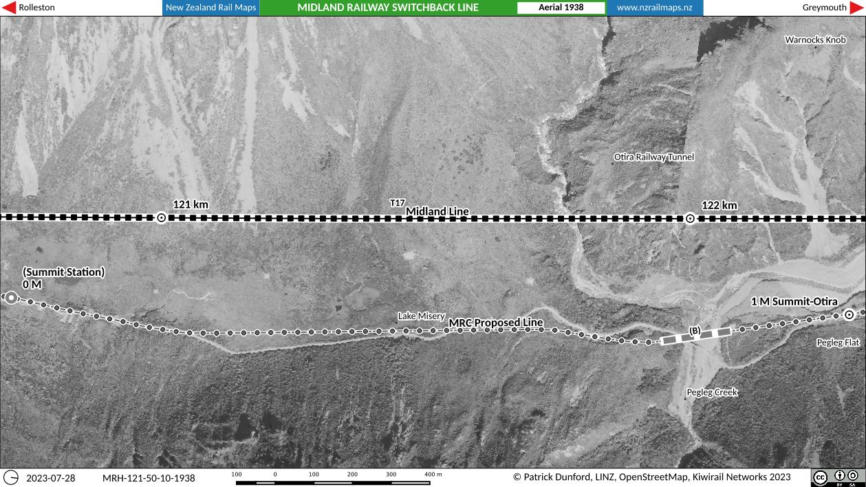
Kopeki Station would have been 1 mile 15 chains below the summit on its western side and basically at the location known as Deaths Corner where prior to the opening of the Otira Viaduct in 1999, the notorious highway descent onto the Zigzag was encountered by motorists. The Zigzag was a feature of the original highway that endured for 133 years from its opening in 1866 until the advent of the viaduct. The railway would have avoided all of the road’s dramas as this point by crossing to the opposite side of the Otira River valley and remaining thereon all the rest of the way downhill.
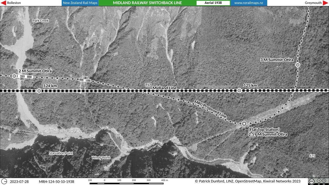
As the railway continued its descent in the Otira River valley, a significant bridge was required at the 2 mile point, labelled “Park Creek” in the plans. The next bridge was at “Hodge’s Creek” and then at 2 miles 59 chains the line reached “Flat Top” Station. This was not a linear station surrounding the main line at this point; instead it was proposed to be located on a dead end siding off the main line. As the corridor left Flat Top it curved 90 degrees towards the Rolleston River valley passing the 3 mile peg.
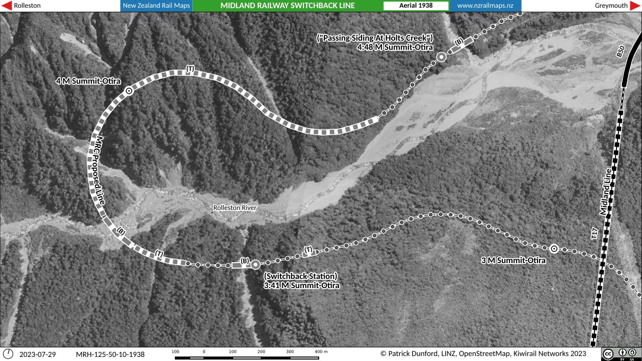
The switchback line is shown as the route entered the Rolleston River valley. This was the only section of the line that was actually considered as a switchback section. The switchback as proposed was eliminated on later versions of the drawings by the long horseshoe curve and its accompanying tunnel. In railway engineering in general, horseshoe curves and switchbacks are two ways of achieving a significant change in altitude whilst keeping a reasonable gradient, but switchbacks are much less desirable because of the need for directional reversal and limitations on train length. However, the main challenge for a horseshoe curve is to keep the curvature from getting too sharp. In this section of the maps, the railway would have required three tunnels (the longest being about 1 km in length, and all on a 1 in 15 gradient) and several bridges, the largest being over the Rolleston River itself. This location is proximate to where the actual present Midland Line exits the Otira Tunnel and crosses the same Rolleston River about 1 km downstream. As originally drawn the switchback line was expected to keep the railway on the right bank of the Rolleston River which would have taken it down to Dyers Flat where a railway station was proposed called “Otira Gorge”, near the later Otira Gorge Hotel. However, the drawings used to produce these maps are assumed to be later editions which cross over to the left bank of the Rolleston River at the switchback site and stay on that side of the Rolleston all the way into Otira, just as the Midland Line does today. A passing siding was proposed at Holts Creek and one of the options considered for it would have provided for a double track across the Holts Creek bridge.
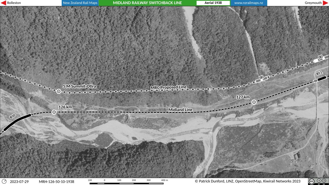
Here again the switchback line on the drawings parallels the actual Midland Line in the Rolleston and Otira River valleys. The grade eased out at this point with the end of the 1 in 15 incline section. The Otira Gorge hotel can be seen at lower right in this map near the main road bridge that crosses the Rolleston River from its right to its left bank. The Otira Gorge railway station was proposed to be located on Dyers Flat near the hotel as mentioned above in earlier proposals for the railway to go down the right bank of the Rolleston before crossing over to the left bank somewhere near the road bridge.
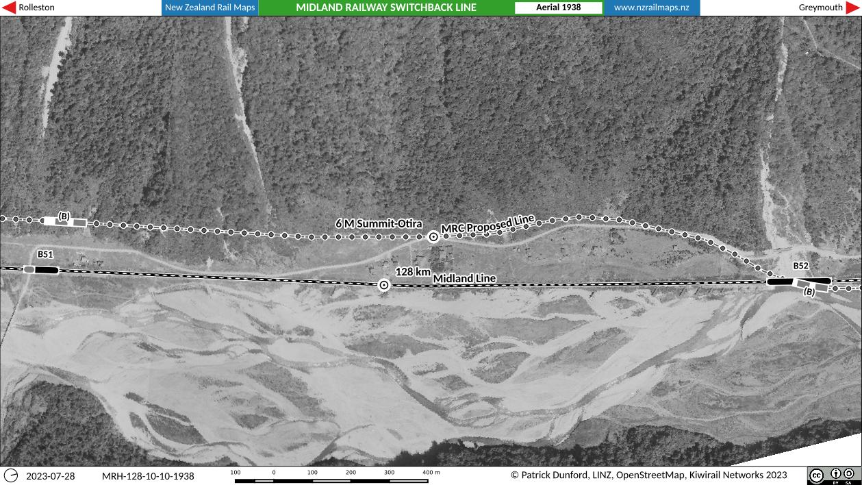
Along this section of the railway approaching Goat Creek it is noted only that the MRC Co proposed to take its line slightly inland of the present route. On the one hand, the present route is more susceptible to river flooding and erosion. On the other, it is less prone to landslides from the hillsides above. Hence, the factors involved in choosing where the railway runs today are complex and require a careful balancing act. There are many factors that are inherent to the choice of bringing a railway through a river valley especially one where the railway is only mere metres above the ordinary riverbed level, and these factors are in turn a reflection of the general difficulties of transport corridor construction in undulating terrain.
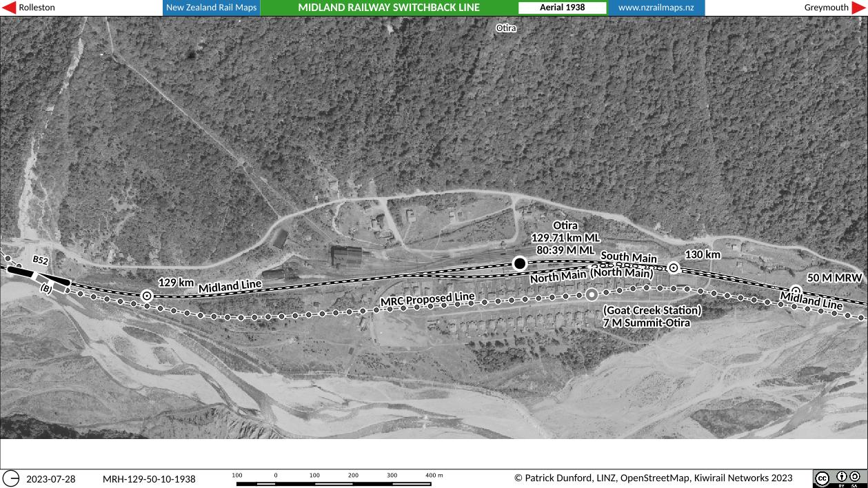
The last section of maps shows the switchback rail line corridor reaching Otira, or “Goat Creek” as it is shown in plans. This name was adopted for the first Otira station when the PWD opened it, but was changed to its present appellation just before the section was handed over to the Railways Department in 1900. Note the milepost marker to the right which shows “50 M MRW”; this refers to the distance from Greymouth, which is how the mileages were shown on maps prior to the opening of the Midland Line in 1923. After that date all distances were measured from Rolleston, which resulted in Otira being places at 80 miles 39 chains, or 129.71 km at the present day.
Well that is really an interesting historical footnote about how the Midland Line was first planned to cross the Southern Alps. We know today, of course, that the Otira Tunnel was the correct route to be chosen; not the least because a railway over the summit would have been very slow and expensive to operate, and in winter would have often been closed by snow, just as the highway sometimes is today. Moreover, in the heavily broken and fragile country that the highway still traverses to the present day, construction and maintenance of a summit railway would have been a very expensive undertaking. A portion of the switchback railway route lived on to be considered for the Otira Tunnel. Such a line (known as B1 in the comparison tables) would have had a reduced grade of a maximum of 1 in 33 but the tunnel itself would have been much shorter than the present route at 3 miles 32 chains, with the western portal at Park Creek. The Otira Tunnel as constructed was estimated to cost around 510,000 pounds but the final cost was well over 1 million pounds, or around $200 million in 2023 New Zealand.